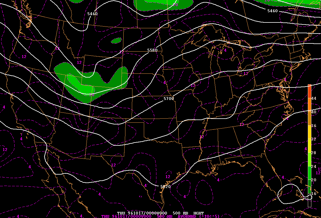
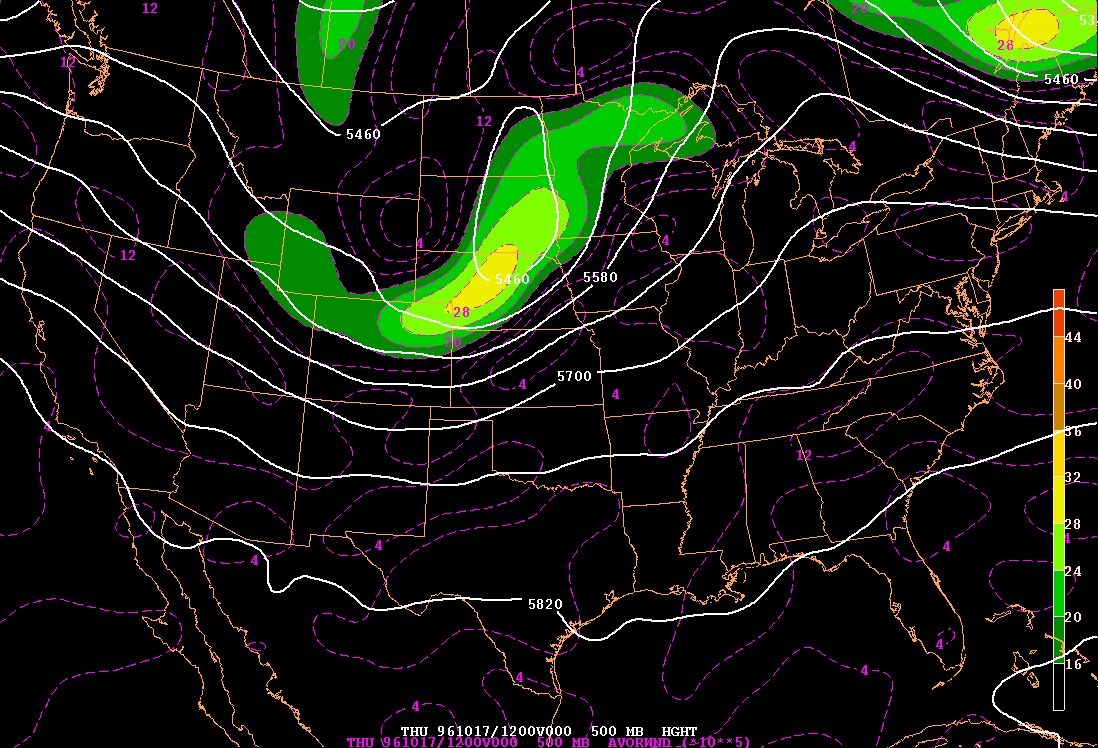
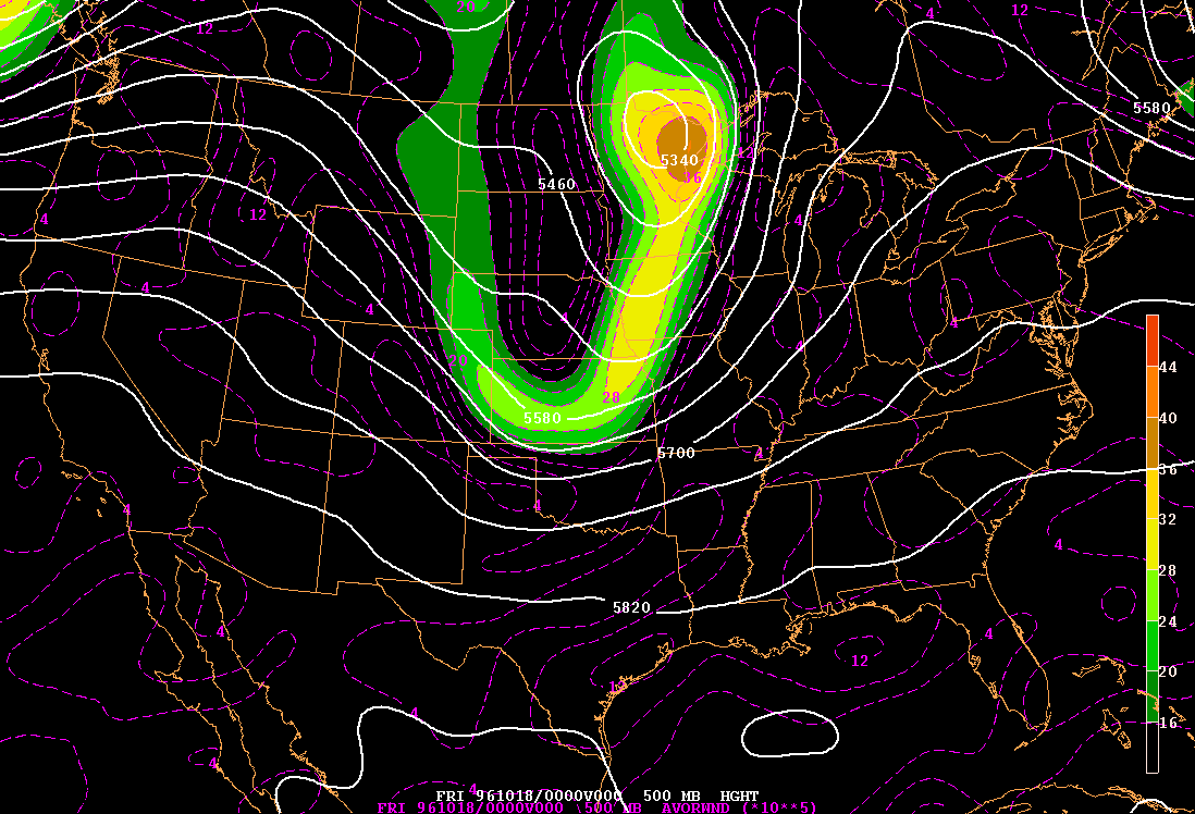
This storm began as an amplifying “shortwave” (a small meander in the jet stream) across the Rocky Mountains. At 00 UTC 17 October, the upper-level trof where the flow turns cyclonically (i.e. the vorticity maximum, shown in green) is located over Utah and Wyoming. The shortwave progresses eastward and by 12 UTC 17 October, the vorticity maximum has increased (shown in yellow within the green). This means that the trof is deeper, and that the jet stream is turning more around it. The main shortwave trof is located over Nebraska and South Dakota. A cut-off low forms, that is a low (shown as a closed white contour) that is cut off from the main polar cyclone found at upper levels. This upper-level low continues to deepen over the next 12 hours as it tracks further northeastward over Minnesota. After 00 UTC 18 October, the downstream ridge amplifies and hinders further eastward progression. Subsequently the storm stretches north-south and develops two vorticity centers: a northern one over northern Minnesota and Canada that tracks slowly northward and decreases in amplitude and a southern one over Illinois and Indiana that tracks slowly eastward. This southern branch eventually forms a semi-stationary cutoff low over Ohio and is associated with substantial rainfall and some flooding over Ohio and the northeastern US on the 20th of October, 1996.
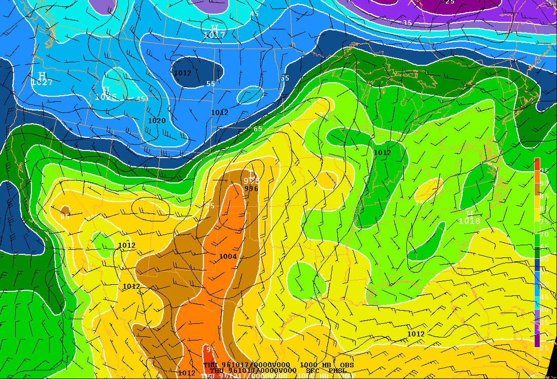
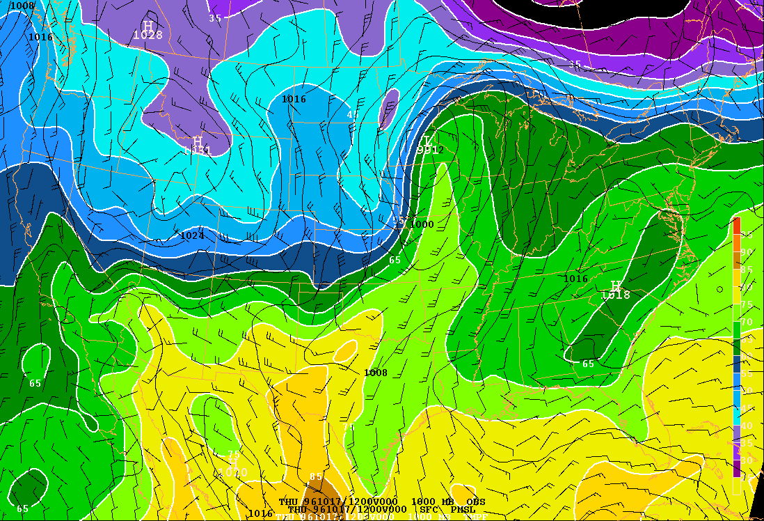
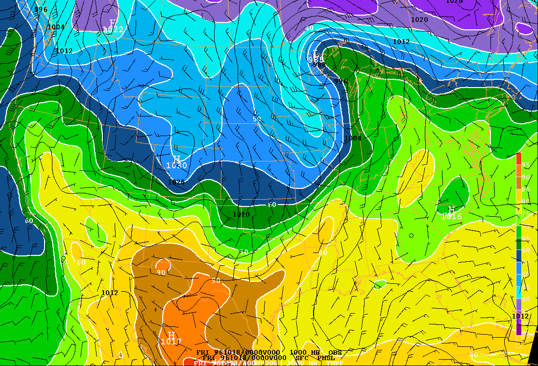
At 00 UTC 17 October, the surface low-pressure center (or low for short, shown in thin black contours) is located over western Kansas with a central pressure of 995 mb (white letters in the low). Temperature is shown in colors. The strongest thermal gradients associated with this storm lie along the cold front that extends from the low through northern New Mexico and along the warm front that extends from the low through central and eastern Nebraska. The thermal gradients along the rest of the warm front, through Iowa and Wisconsin, are much weaker. By 12 UTC 17 October, the surface low has progressed northeastward and although the central pressure has only deepened to 992 mb, the pressure gradients around the low have strengthened and the cold airmass has been advected southward (east of the low) and the warm air has been pushed northward (west of the low). The surface low continues to deepen over the next 12 hours (00 UTC 18 October) and the thermal structure indicates that the storm has begun to occlude: the cold air has begun to wrap around the low, pushing the warm air aloft. The surface cold front remains strong throughout the lifetime of the storm dropping the temperature about 20ºF (or 11 K) in 24 hours in the Midwest. By 12 UTC 18 October, the surface low begins to fill and the storm structure weakens with time.
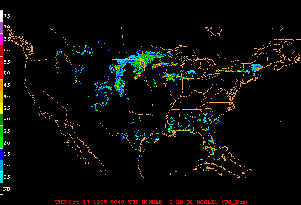
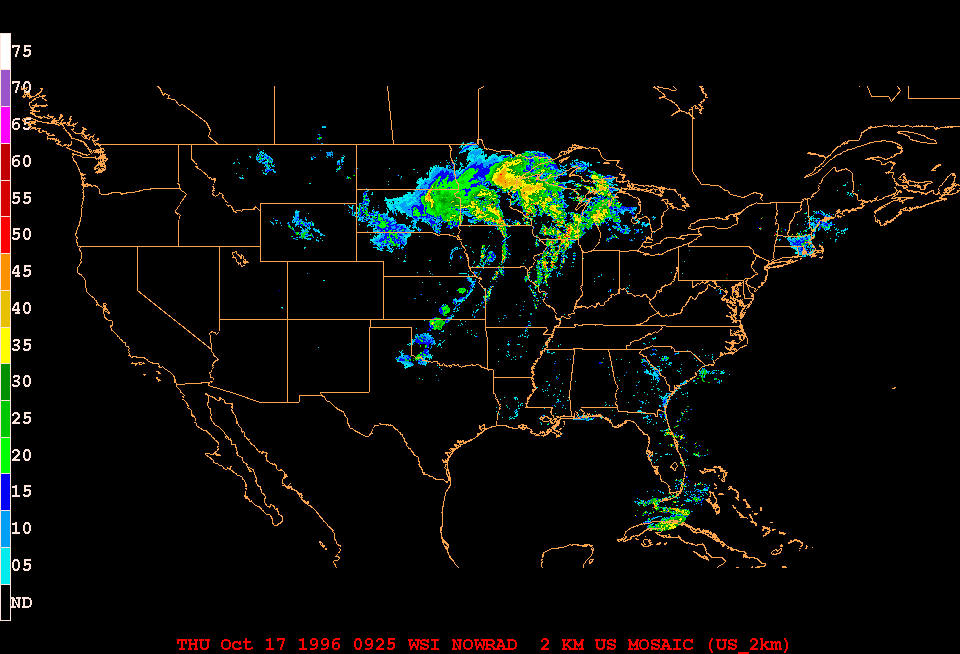
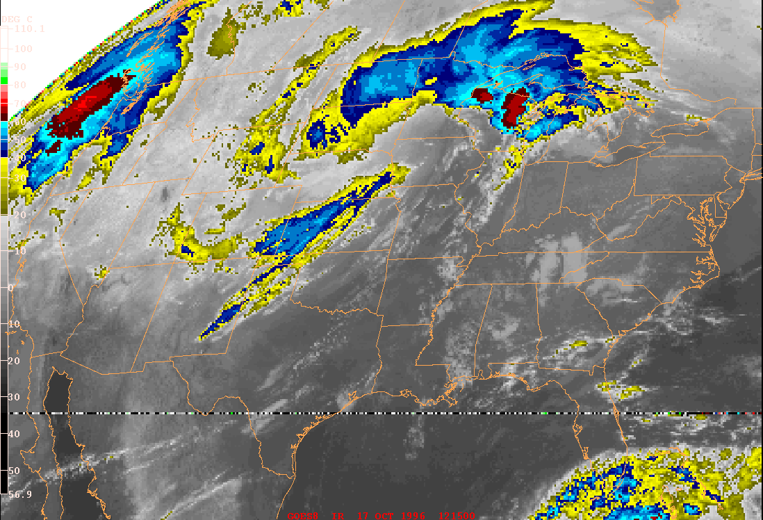
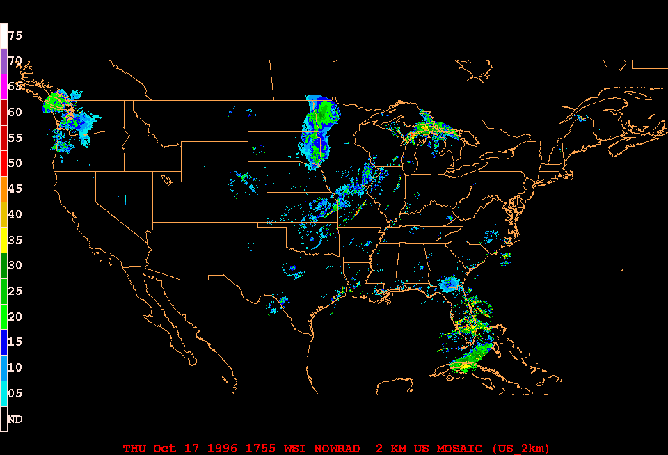
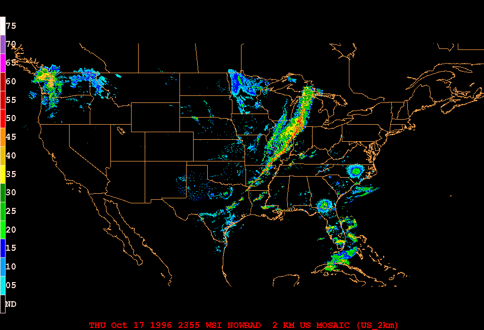
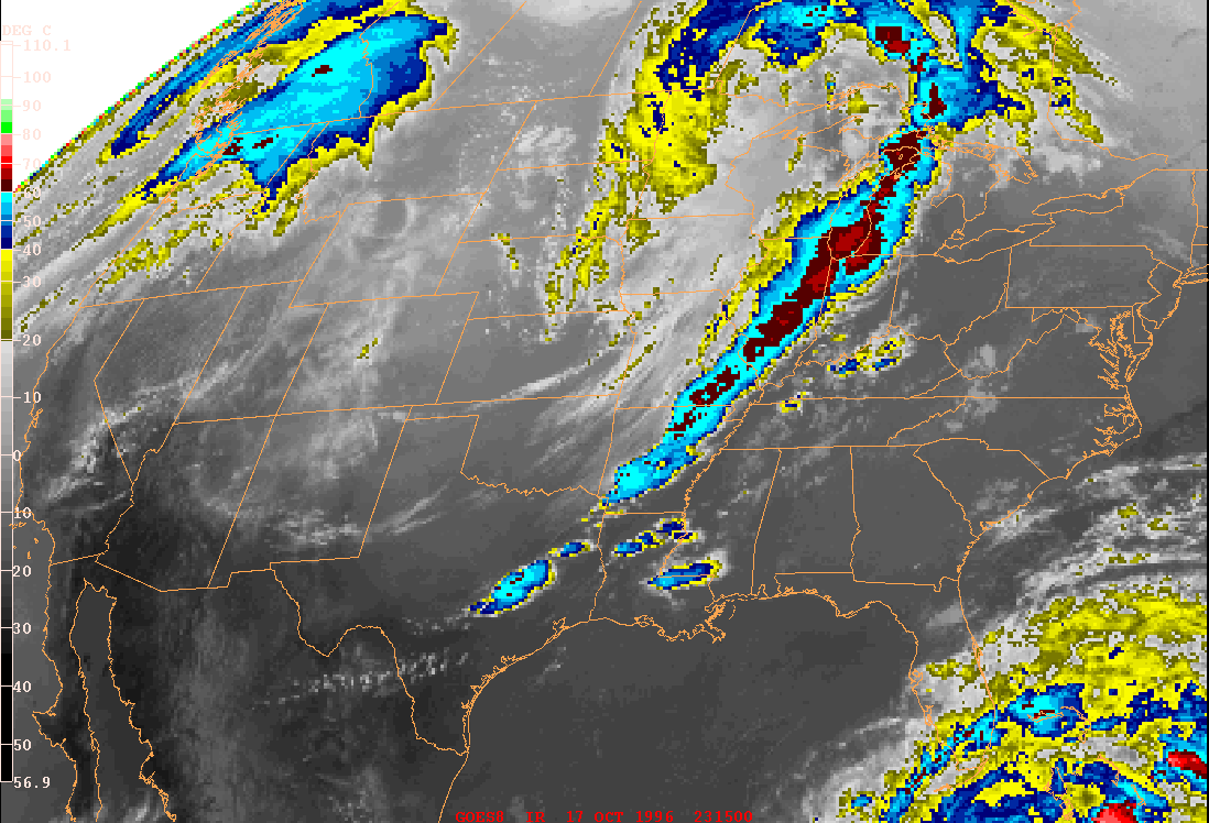
During the early stages of the this storm, the majority of the clouds and precipitation lie north of the surface low and even northeast of the warm front. Within this large cloud mass, Thunderstorms break out over eastern Nebraska and S. Dakota in the afternoon of 16 October (see radar image), and they move towards Wisconsin and northern Illinois where they die out in the pre-dawn hours. A massive cloud deck over Minnesota and northern Wisconsin around dawn (12 UTC 17 October) suggests continued heavy rain there. In contrast, there is a significant dry slot that forms over the surface low and northeast of it over the period 06 UTC to 18 UTC 17 October. It is associated with subsidence forced by the jet stream. Also, the air over the surface low originates from the desert plateaux of the southwest, so it is much drier than the air from the Gulf of Mexico that has moved north of the low and produces all the precipitation there. There are only low level clouds along the surface cold front until a squall line breaks out along the front around 18 UTC 17 Oct. This becomes a massive squall line by 00 UTC 18 October (see radar image). The result is a large deck of anvil clouds. That they are thunderstorm anvils, is suggested by the very low IR brightness temperatures.
Back to the Post-lab assignment